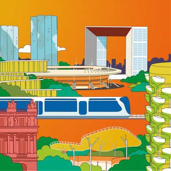
The "Terres en mouvement" exhibition, 1st act of the "Terres et paysage" chair, the fruit of a partnership between the Ecole Nationale Supérieure and ECT
This exhibition, with its evocative subtitle “an examination of embankment landscapes in the Ile-de-France region”, took place in the prestigious setting of the Figuerie du Potager du Roi, during the Biennale d’Architecture et de Paysage de Versailles, in June 2019. With 2 curators Marie-Laure Garnier, landscape gardener Dplg and Romain Bocquet, landscape gardener Dplg-jardinier. The success of this exhibition led ECT and ENSP to decide on the production of a digital catalog, prefiguring the design of a graphic line dedicated to the work of the “terre et paysage” chair. The exhibition was also an opportunity to show a first glimpse of Anne-Marie Filaire’s work on the ECT sites.
An examination of backfill landscapes in the Ile-de-France region
The manufacture of the city generates a considerable and growing volume of inert soil. Extracted from the ground and subsoil, they are stored and reused, creating new landscapes.
As part of the partnership between ENSP and ECT, the exhibition was designed to take us behind the scenes of this landscape factory. His aim is to take a fresh look at these “constructed”, totally man-made embankment areas, whose movement and layout the landscape architect orchestrates. The exhibition also highlighted the qualities of use, the environmental qualities and the landscape that can be expressed.
Contemporary sites in the Ile-de-France region whose recent construction is or was managed by ECT were used as analysis sites, echoing historical embankment sites such as the Potager du Roi, Parc Georges Valbon in La Courneuve and Colline d’Elancourt.
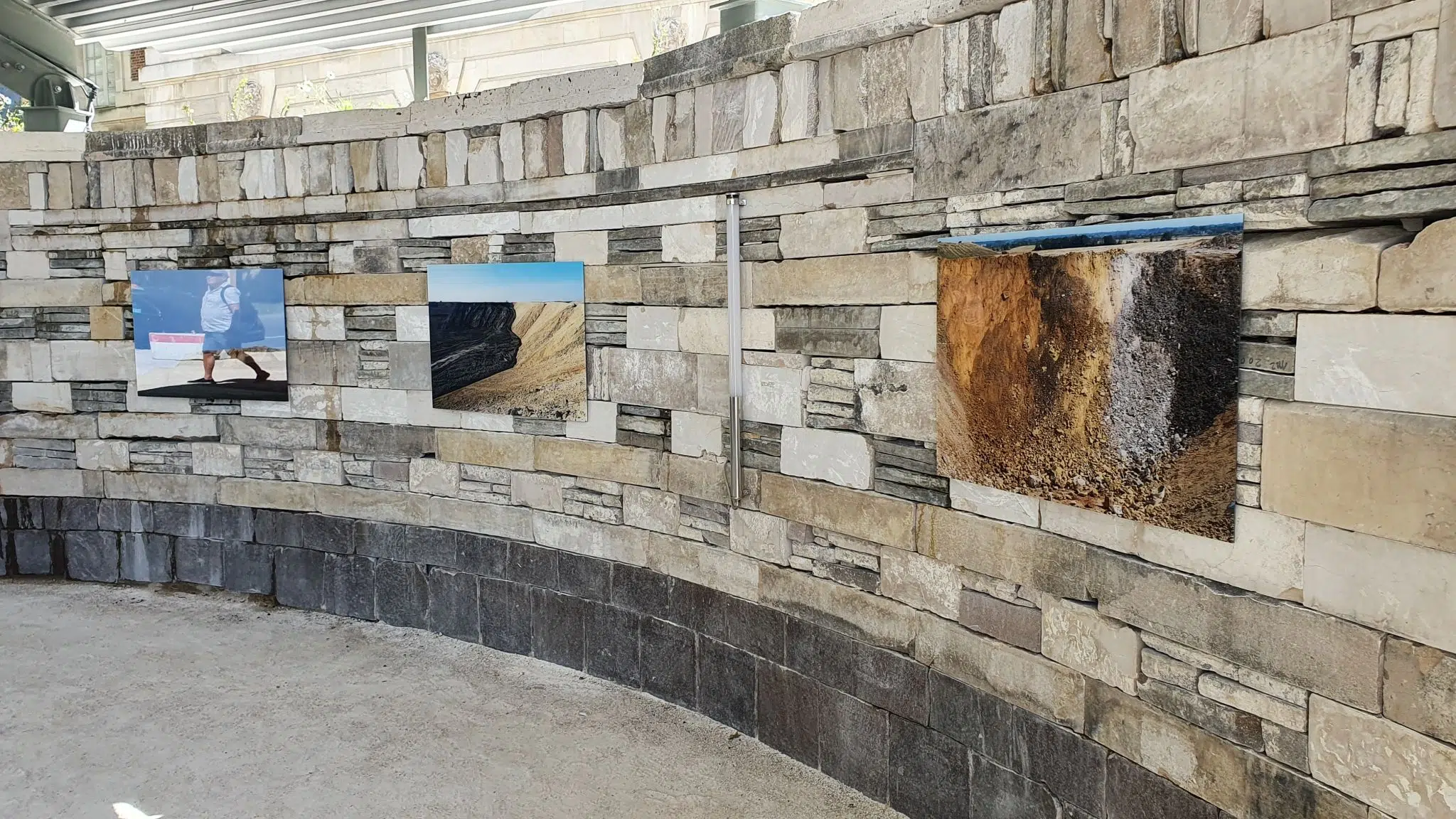
The exhibition also featured the work of photographer Anne-Marie Filaire, commissioned by ECT.

The King's kitchen garden and the fertility of embankments
The transformation of a marsh landscape, uncultivated and uncultivable in its current state, into a nourishing landscape, required major transformations, both in the architecture of the site, and in the contribution of external elements.
Garden architecture
The Potager du Roi, a French-style garden of classical architecture, features a highly elaborate, orderly, geometric landscape composition, combining simple rectangular and circular forms. The squares that make it up form a coherent whole, organized around a central pool, giving an overall impression of order and harmony.
Can we imagine, however, that this harmony was also, in the 17th century, the judicious tidying up of the waste from a new town, Versailles?
In some driveways, embankment terraces and even parts of the garden, you’ll find shards of porcelain, pieces of marble, bricks, cracked objects, put there to fill holes, ruts, speed bumps…
In some of the trellised walls, mixed with the millstone, are elements of benches from the Potager itself, dating from the 17th century or even later. One of them reveals a carved plant, a mischievous nod to the mace, a marsh plant, or a stylized lily, symbol of the monarchy?
Parc de La Courneuve, a landscape composition
A park in retrospect
In / Mémoires d’un Parc (based on research by Elizabeth Duval) (La Courneuve, le Parc, 1925-2005-Allain Provost)
1925: The Département de la Seine acquires 410 hectares of land in the Plaine de la Courneuve, belonging to five communes: La Courneuve, Stains, Dugny, Saint-Denis and Le Bourget. His intention is to create a satellite city.
1934: The Prefecture of the Seine suggests creating a vast green promenade here, as a northern counterpart to the Parc de Sceaux to the south. The ten neighboring communes have a population of 300,000, and we hope to increase this to 600,000 half a century later. Work in progress
are taking place, which can be seen as the first step towards the park’s completion.
1956: a prefectoral decree appoints Albert Audias of the Préfecture de la Seine as operational landscaper. This is an initial study covering an area of around 500 hectares. “The idea is not to turn the future park into the Bois de Boulogne or the Bois de Vincennes, to treat it like a Parisian park, or to turn it into a vast forest. We’re talking about a local park in a densely populated industrial region with few public green spaces.
1970: Creation of new departments,
First phase, designed by Audias, scheduled to open to the public on July 1, 1970 (by order of the Prefect).
Second tranche: Audias cannot be the prime contractor
1971: The first national landscape design competition is held for the park.
19 teams are competing. Allain Provost, Gilbert Samel, J.M Whalley are the winners. Their association lasted over thirty-three years.


In Annet-sur-Marne, when the valley rises
It’s a valley that rises upside down. A far cry from the usual valleys, sculpted by the erosion of water that gullies and erodes their slopes. Here, the earth rises and settles respectfully around the electricity pylons.
The politeness of the earth, which avoids the aerial feet of the pylons, means that the natural ground on which they stand will become the future talweg of an artificial valley, with its edges raised by successive embankments. will form a new watershed, guiding water into its hollows and supporting wetland vegetation.
This is what we’re beginning to see, what already exists, and what is repeated and found on other sites: the meeting of power lines and inert soil storage facilities creates an unprecedented landscape dialogue, where the earth comes to border, avoid the pylons, create undulations, sometimes windows or breakthroughs in the surrection of artificial hills. […]
The Elancourt hill, a little geography lesson
It’s a story of rolled-up fields. New towns were built in the years that followed.
1970. Saint-Quentin-en-Yvelines, Elancourt, Montigny-le-Bretonneux…
This is the story of a millstone quarry on a ridge. The quarry forms a kind of hollow tooth.
It’s the story of a city’s rubble, the waste that gradually fills the quarry.
It’s the story of a quarry that inverts its relief, gradually growing, transforming itself into a hill.
This is the story of a hill that became the highest hill in Ile de France. Its highest point, 231 metres high, was built from the waste
of the city in motion, covered in earth, covered in vegetation.
It’s the story of a hill that wants to become a mountain. Already taking on the trappings of the region, dressed in adret and ubac […].


Forges, when the valley becomes a hill
In the distance, you can see the wooded cordon that marks the edge of the plateau of the Chevreuse Valley NRP.
The hidden career. Field folds. Woodland edges.
Before the land was stored, there was a clay quarry for firebricks… Between the diffuse mesh of trees, a gently sloping plain forms a small valley in its talweg, with bodies of water on the land. Different earth tones, beige, brown and blue, blend together.
Orange markers, a metre from the ground we’re treading on, seem to show, like beacons at sea, the future level of the earth. We’re still below ground. You don’t have to take that into account anymore. Between the first application and the second, the project evolved, and the volume of land planned increased. So much so that all of a sudden, today’s high point becomes tomorrow’s low point, and part of the valley becomes a mound.
On the site, water is a major issue: at the edge of the site, an SNCF embankment carries a TGV track. At the foot of the embankment, water accumulates and risks rendering the embankment unstable. At present, the water is pumped continuously. The future ECT project on the site attempts to solve this difficult equation. […]
In Moissy-Cramayel, the fields grow taller: the changing landscape between town and country
It’s the key to a movement in the evolution of landscapes that can be seen here. Or how major development projects generate a whole territorial dynamic that transforms the landscapes of the Paris region.
The infrastructure created (roads, railways, etc.) opens up a window of opportunity for building. Acoustic mounds provide protection
soundproofing around plots of land to block noise pollution. All of a sudden, an area that is not very suitable for building, such as a roadside farm, becomes a potential site for urban development.
The city expands, conquering agricultural areas. The artificial mounds created by depositing the soil provide acoustic protection for the new inhabitants, but also, paradoxically, a refuge for the fields… Because on a mound you can’t build: the soil, less compacted than the natural terrain, doesn’t guarantee sufficient bearing capacity for the foundations of the dwellings. However, there’s nothing to prevent today’s inert, backfilled land from once again forming fields, meadows, woods and other forms of agricultural land.
The modification of the topography and agronomic quality of the soil, linked to the deposition of topsoil over many years, as well as the addition of fill that does not necessarily have the same physical characteristics, PH or microbial life as the previous soil, may imply new uses or cultivation methods.
Perhaps we’ll see a return to livestock farming on these slopes, to amend the soil, or a resurgence of certain ploughing practices using draught animals to improve soil work. Today’s artificial mounds are more than just a landscape amenity for the new populations living at the foot of the mounds. In areas of high land pressure, they may well be one of the few agricultural spaces of tomorrow.
On these sites, everything has yet to be invented.