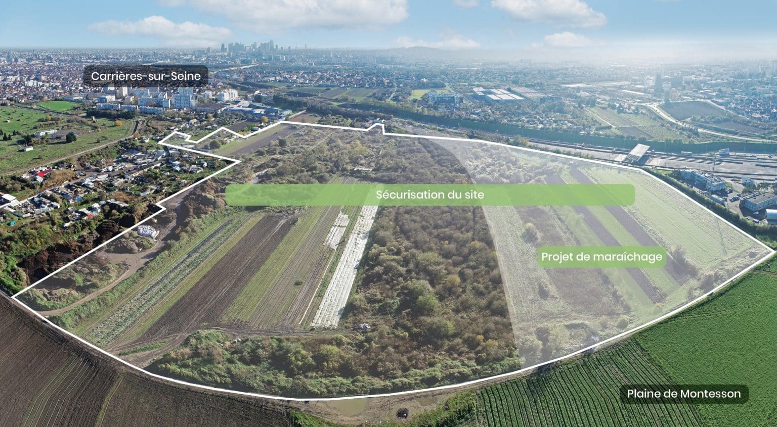
Carrières-sur-Seine (78)

- Yvelines (78)

Rue de la Grue
, 78124 Carrières-sur-Seine

GPS coordinates:

48.913225, 2.171397

Securing a dangerous site and revitalizing a market garden

Types of layout

Agricultural Focus

Picto, icone, remblaiement

Backfilling and securing quarries

Key Issues:

Farm rehabilitation

Securing the site

Status:

During operation,
soil additions

Project Overview

In partnership with the Communauté d’agglomération Saint Germain Boucles de Seine and Grand Paris Aménagement, the town of Carrières-sur-Seine has embarked on an ambitious 84-hectare ZAC project. Located close to the Montesson market-garden plain, the area is situated on former limestone quarries that have not been refilled, and presents serious and proven dangers. For the town and the public authorities involved, making it safe is a complex priority to achieve and finance.

The concerted project, led and implemented by ECT, provides a solution to the financing constraints of securing the quarries and rehabilitating part of the site for market-gardening use.Thanks to the reuse of inert soil from the local building and public works sector, the project can be carried out and financedat no cost to the community and public finances:

  • Securing 16.5 ha of hazardous land.
  • Rehabilitation of 2.4 ha of agricultural land and 2.5 ha dedicated to biodiversity

Key Figures

Phase 1

  • Securing by backfilling
  • 17 months of work
  • 440,600 m³ of reclaimed inert soil

Phase 2

  • Creation of a new market garden plateau
  • 185,400 m³ of reclaimed inert soil
1

hectares

secure underground quarries

1

hectares

requalified for market gardening

1

hectares

ecological restoration

1

trees and shrubs planted

Partners

Logo-Saint-Germain-Boucles-de-Seine
Grand Paris Aménagement-logo
logo - Carrieres sur Seine

Project Lifecycle

Plan d'aménagement - Zone de maraîchage

Revitalizing a market-gardening area

Following the securing of the quarries, the project includes the creation of a market-garden plateau on part of the site and the renaturation of the area:

  • Landscape transformation, improving thesite’s agricultural andecological quality.
  • Raising, reshaping of degraded land and containment of polluted soil, using inert soil from local construction sites.
  • Traceability and control of inert soil brought to the site.
  • Evacuation of camps and demolition of light buildings.
  • Disposal of litter through appropriate and approved channels
  • surface (estimate = 495 K€)

These operations will create a fertile substrate in situ, suitable for market gardening and the resumption of agricultural activity on rehabilitated soils.

The project will integrate the creation of wetlands and the creation of vegetated embankments with diversified plantings (copses, bushes, sainfoin grassing). These features will help to structure the landscape while promoting biodiversity by creating habitats suitable for birds, pollinators and small wildlife.

Securing the basement

ECT is in charge of filling in the former quarries.

  • Securing the site and eliminating the risk of collapse, both above and below ground, by filling in 75% of the underground galleries .
  • Traceability and quality control of inert soil from local construction sites , used for backfilling.
  • Evacuation of litter from galleries to appropriate, approved facilities (estimate = 534 k€)
The use of traced and controlled inert soil from local construction sites will ensure the long-term security of the subsoil and surface land. As well as financing operations.

Further information

Environmental and social quality of ECT development projects

Financing and project development

Land traceability, a major challenge

See our examples of achievements

Pour recevoir
les dernières actualités d'ECT