Our subsidiaries :

Essonne

A new riding school in Essonne

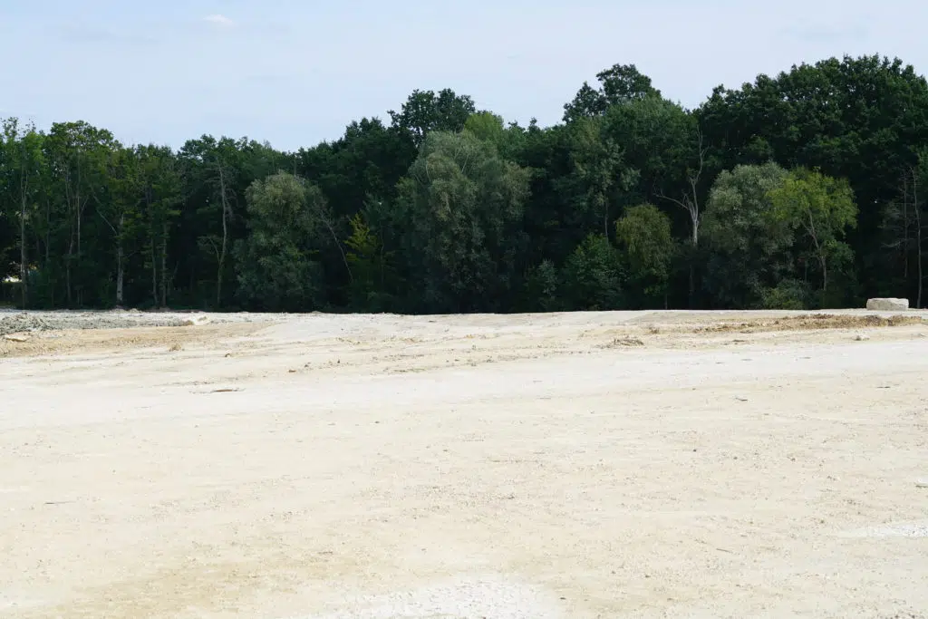
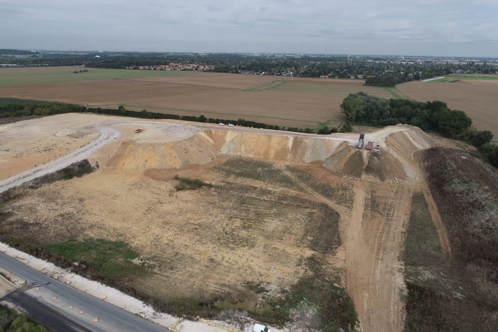
GPS coordinates : Download the brochure Types of layout Outdoor sports and relaxation area Issues : Sport in the city Status: Development in progress Project presentation The project aims to rehabilitate a derelict site into an equestrian center. It was designed in partnership with the future owner of the equestrian center, the Comité départemental d’équitation de l’Essonne and the commune of Chevannes, and drawn up by landscape architect Laurent Latte (CPA Conseils). Key figures 2020 Start of development with soil inputs 1 hectares rehabilitated as an equestrian center Project life Chevannes schoolchildren plant trees at the riding school December 2023

A new riding school in Essonne Read More »

A community archery range

GPS coordinates : Types of layout Sport in the city Issues : Sport en Ville Status: Landscaping completed Project presentation Rethink the city of tomorrow to enable the commune to benefit from new, concerted uses. Bring sport to the city with the creation of an archery range. Key figures September 2019 Project start-up 1 m² of sports surface area Project life The Compagnie d’Arc de Morangis opens the doors of its archery range Since the beginning of the year, archers have been training on this rehabilitated archery range. ECT created this plateau using excavated soil from construction sites in the

A community archery range Read More »

Rehabilitation of a former clay quarry

GPS coordinates : Types of layout Nature area, reforestation Issues : Renaturation Status: In operation, soil inputs See the site in operation Project presentation Backfilling and securing a former clay quarry Project life Anne-Marie Filaire photographs the site Forges-les-Bains is one of the 6 sites photographed by Anne-Marie Filaire. This groundbreaking documentary work can be found in his book “Terres, Sols profonds du Grand Paris”, published on September 17, 2020 by Dominique Carré – La Découverte. See photo gallery History of the “Carrière de Bajolet” site Quarrying began in 1924. It is open-cast mined for clay. Taken over in 1979,

Rehabilitation of a former clay quarry Read More »

Improving golf course design

GPS coordinates : Types of layout Golf development Issues : Golf course optimization Status: Landscaping completed Project presentation In partnership with UGolf, ECT reprofiled 4 holes, reusing in situ inert soil from local construction sites. Objective: to enhance and diversify the golfing experience. Partners Project life UGolf Sénart, a successful reprofiling. Offering golfers a new playing experience and new challenges: these were the challenges of the developments at Sénart UGOLF. Thanks to the technical skills and precision of its bulldozer operators, ECT reprofiled the last 4 holes (15 to 18) using inert soil. Watch the video A project to reconfigure

Improving golf course design Read More »